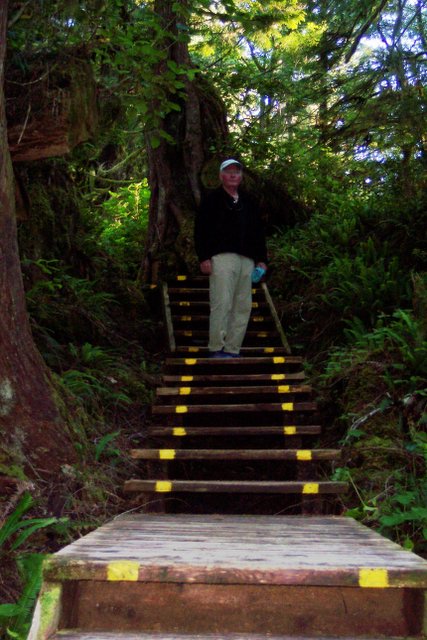
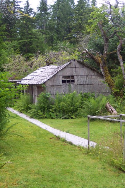
VIA - the Vancouver Island Adventure Trip

Detailing our circumnavigation of vancouver island by sailboat. Check out the May archive for background and planning information.

Wednesday, August 16, 2006

Final Post

LOOKING BACK.

As a final entry to this trip log I wanted to summarize the trip and add some of my own reflections on the trip and the process.

THE FACTS, in no particular order:

>During our 48 days “at sea” we traveled 892 nautical miles; original plan estimated 900 to 950 depending onside trips.

>We had 13 layover days ( 10 for weather, 2 for engine repairs, 1 to visit my nieces). This gives a daily travel average of about 25 miles/day

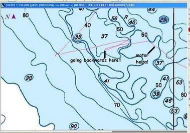
>We motored for about 66% of the time. Unexpectedly the best sailing days were on the inside passage on the way up the island and when we entered Juan de Fuca straight on the way back. To be fair, on the west coast, the exploring is done in the sounds and inlets and there are not many days actually off-shore where there would be higher probability of wind and sailing.( unless you want to make it a short “let’s get back” type of trip.

>The “all in “ cost ( food, fuel, cafes,moorage) was an average of $20/day per person. This increased on the last leg because there was more moorage and only 2 crew. ( plus more eating out as we hit civilization!).

>Our garbage management scheme of using a “compost” container for wet garbage and ensuring we stored recyclables ( cans/jars/paper)meant we only had about 3 bags of actual garbage for the whole trip.

MISC:
I obviously did a good job in choosing a crew; we had no major disagreements or upsets. I am amazed that anyone could put up with me in a closed space of a sailboat for so long. Thanks Ralph and Stewart for being so understanding and tolerant.

For another trip, I would want to increase the amount of and variety of baking; it makes for good eating and helps with moral, especially when it is wet and cold.

The combination of having no fixed schedule other than a rough outline ensured that we were under no pressure to make questionable decisions regarding travel and the weather. The real pressure is in deciding on what to see and what to leave for “next time”; there is more to see than can be done on one trip unless of course it is limitless.
I was encouraged by our talks with Dave from “Die Flynn”; he has circumnavigated over 20 times and always finds something new to see.

Being cognizant of water usage and using saltwater for dishes, teeth, some cooking, etc helped to minimize our fresh water consumption considerably. We would have been able to go for at least 3 weeks with both tanks without refilling if necessary. Loosing ½ our fresh water at Bull Harbour certainly gave us the needed motivation to be careful with water!

REFLECTIONS:

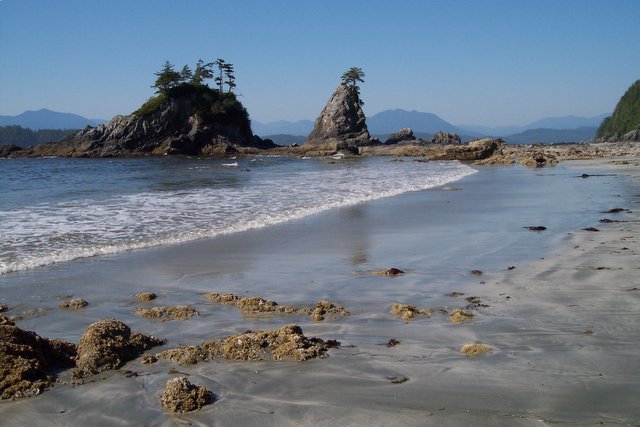
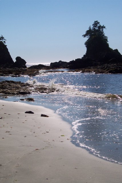
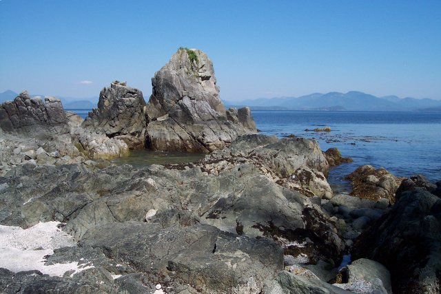
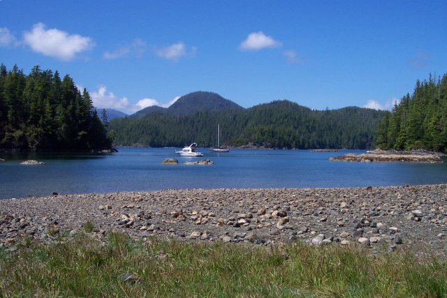
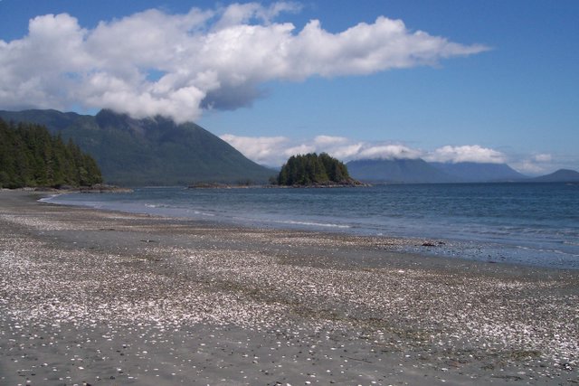
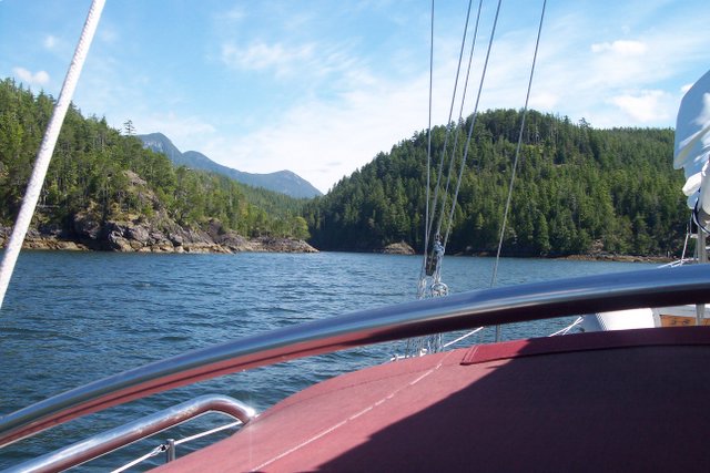
My expectations of what I would see and experience were quite different in some respects from what happened. I thought we would be on/near sandy beaches a la Long Beach a lot of the time. Obviously, they exist but not anywhere where you can park your boat; you have to hike or dinghy to get to them. I did not know how rugged the landscape is; both the seacoast and the mountains and inlets.

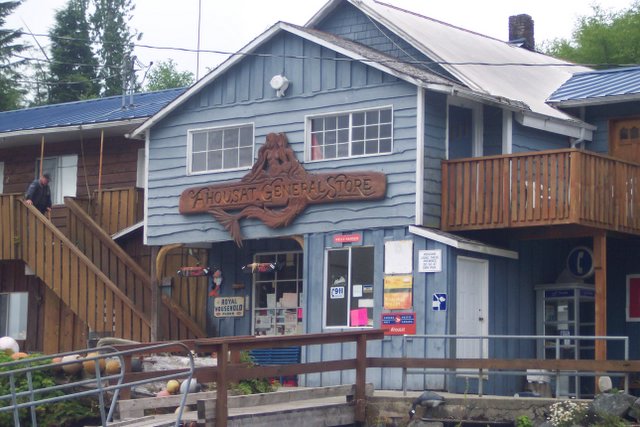
I found most people to be very friendly and a bit philosophic about the changing conditions ( forestry and fishing down, towns were shrinking but trying to reinvent themselves, etc. No one seemed bitter or accusatory but had an attitude that they would get over it and move on. This is certainly more true north of Tofino.

The surroundings, the wildness and the people all seemed to contribute to getting into a space where I no longer needed to get a daily update on the latest crisis; it doesn’t mean that you don’t care, but it can be a habit – the need to catch the news 3 or 4 times a day on the radio and reading the Globe and Mail.

It is also hard to explain how you can get into a space where you can pass a day at anchor without a whole lot to tally up on a TODO list. Maybe we should promote an extended cruise as therapy and have it covered by Medicare!!

I expect to do this trip or at least portions of it another time. The areas north of Seymour narrows on the east side are more than worthy of further exploration. I would not hesitate to revisit the west coast via Juan de Fuca; although that could be an "uphill" ride, it would certainly be possilbe especially by carefully watching the weather for a good window.

Tuesday, August 01, 2006

Canoe Cove at last

WE are finally back at Canoe Cove, E dock. I'll send a final wrapup of the trip when I get back to Calgary on Thursday.....cheers and thanks to all who took the time to read this stuff. Posted by Picasa

Haro Straight in 20kt winds

 Posted by Picasa

Race Rocks: almost home

The Race Rocks lighthouse and we are soon going to be pointed North and going back to home port! Posted by Picasa

Another !!?? beach photo??

yes, another photo of Brady's beach... Posted by Picasa

Brady's Beach: Bamfield

This is on Brady's Beach, Bamfield. A short walk from Bamfield by road...no cross country trails this time! Posted by Picasa

Bamfield 1 - Lady Rose

The Lady Rose pulling in to Bamfield inlet; board walk that extends the whole length of West Bamfield is on the right. Posted by Picasa

Effingham Bay: navigation class

Ralph waiting for Jupiter to rise; part of my celestial navigation lessions Posted by Picasa

Effingham Island: beach walk

This is the beach walk on Effingham Island, site of old Native village. Posted by Picasa

Effinham beach:artsy photo

My attempt at being artistic. Posted by Picasa

Effingham bay: beach walk

Rocks at the beach on effingham island, near the old native village site. No signs remain now other than the old midden and village site that is starting to get covered in trees. Posted by Picasa

Ucluelet: whale siting

here is the Humpback whale we got close to , although it looks far away in the photo.
I'll publish some more photos since I have the chance here using Ralph and Roena's hotel room;
I've also published the missing days that didn't get to the blog update for some strange reason.... Posted by Picasa

Day 42: published late, too

Day 42 – more motoring!!

More loonshit to deal with after we raised the anchor!

It was a quick motor across to Bamfield; we could have sailed for the last hour or so, but we didn’t – low energy day. I did not sleep well last night; even worse than usual for this trip. It was hot below last night and after hearing the 01:30 bell, I went topsides with a beer, my headlamp and read for a while; then I just sat in the dark and looked at the stars. I haven’t seen such a clear sky since we lived on our acreage near Cochrane; quite a sight.

There was a low level noise that sounded like freeway traffic which was the sound of the pounding surf a few miles away. I think I finally went to bed about 3 a.m. and then not sure when I actually got to sleep. I’m a grumpy puppy today.

Bamfield is on both sides of the inlet/harbour which acts as “mainstreet”. East Bamfield is connected by road to Port Alberni and Duncan and has most of the businesses including a pub. West Bamfield is more “layed back”..if that is possible and has no road connection to anywhere. The frontage is a boardwalk from the docks to the entrance where the Coast Guard Rescue boat station is. Across from there is the Marine Institute; which is owned by UBC and 4 other university for doing marine studies. It is housed in what used to be the terminal station for the undersea telegraph cable. (In the olden days before satellites and the internet, devices were connected by wire, even if they were separated by oceans).

Bamfield has a nice easy feeling and has to be one of my favourite towns on this trip. The walk across the inlet to Bradey’s beach is “must-do” if you are ever here. Nice sandy patches between dramatic rocky outcrops make for good photo ops!

It was very hot today; it got up to 32 down below at the dock; too hot for me but Ralph seems to enjoy it. I even had to stop him closing his hatch to let some air circulate; I’m sure he is tired of hearing me moan and complain about the heat. I hope Robin is making out O.K; she is driving through the interior today on her way back from visiting her brother on SaltSpring Is.
We are now in the home stretch; depending on weather ( and if skipper gets any sleep) we should be in Port Renfrew tomorrow (about 45miles), somewhere near Victoria the next day and back at Canoe Cove on Wednesday.

Tonight gales are forecasted in our area but they are due to ease tomorrow. We plan on about a 08:00 getaway, weather permitting. If we do go, it will be a longish day, about 9 hours to get to Port Renfrew; my concern is that my lack of sleep on a long day on the water will up the probability of making a stupid mistake. The other concern of course is being out in more wind than we need to deal with and finally, Port Renfrew is not the most sheltered spot; if winds are up and from wrong direction, it may not be the best spot to be. However, there are no other options from here; other than to carry on for another 35-45 miles and be near Victoria; that is not an option in my mind since that would have us finishing a very long day in the dark, tired and burned to a crisp.

Being cautious has worked so far and there is no reason to abandon that plan now; other than the desire to get home now that we can smell the barn.\\


Day 41- published later

Day 41
Anchored at N48 52.68/W125 18.82, Effingham Bay,

We did a small shopping, added some ice to ensure it will last through the heat wave and then filled with diesel. We were off the fuel dock at about 11:00.

Again, no wind to speak of and we motored all the way to Effingham Bay.

Before I go on, I must revised Ucluelet. After ranting on about how touristy Tofino was, I must say how much Ucleulet appealed to me. It has no pretensions ( although there are condo’s appearing and there is the Princess resort); the rest of the town feels like a small Prairie town; a bit down at the heels. There have been attempts to spruce it up, with some pathways,etc but no one is keeping them up and they are a bit run down. The public marina is well run, but it caters mostly to sport and commercial fishermen; there were only about 6 sailboats in harbour when we were there.

It feels like a real town and not like Banff or Tofino who feel like shopping malls with some homes/accommodation attached to them.

So, now that is off my chest, back to today.

After we anchored and had lunch, I made up the shore party of one to find the trail to the east side of the island where there is an old Indian village and sea cave to see. I had to cruise up and down the bay to find the trail entrance but couldn’t. I called Ralph on the portable radio to double check the guide book. I bushwacked in the general direction and eventually found a faint trail. Once you are in the rain forest canapy it is hard to find trails; the duff can fool you into thinking it is a trail. After many false starts/dead ends, I eventually made it to the beach. I had a potentially bad scene when I was walking on a tree bridge which turned out was 2 trees filled with moss; I broke through up to my knee and fortunately didn’t pitch forward or I would have snapped it.

The physical evidence of the village consists of an area that was obviously clear of trees at one time and a huge, 10’ by 100’ midden ( pile of discarded shells) that would have taken a long time to build up! One book says you can find nurse logs ( fallen logs now supporting new trees) that are squared and were obviously beams for long houses. I couldn’t find any.

The tide was still too high to get to the cave; but I did get some nice photos. The beach is mostly rounded boulders and logs. Walking on this stuff forces you to go slowly at a pace to enjoy it. When you stop to look around, you have a new view that you were not aware of sneaking up on as you walk along.
I managed to walk through a patch of nettles; later in the evening, my feet felt like they were asleep…. I’m sure it was all in my head.
Travelling through the Broken Is. Group, it is easy to see why this is a kayaking paradise. It would make a nice few weeks to use the boat as a base and kayak around to the smaller islands and beaches.

We are not spooked any more by the sight of “sea foam”; when we first saw this stuff I thought it was evidence of rocks near the surface. It actually is foam formed by breaking waves on rocks but the foam then drifts away from these areas. It can build up and look like soap suds. It is still unnerving to be moving around within ½ to ¼ mile of rocks poking up through the water. I would not want to be out here in the dark! It is very difficult to identify all the rocks and small islands even with charts and GPS and keep your self properly oriented.


Day 39 & 40: published late

Day 39: Ucluelet
Position: N48 56.79/1256 33.24W

We ended up motoring for 6 hours; no wind at all. To top it off, we were crossways to the swell and were tossed around much of the time.

I could not reach my nieces who are now living here ( Lori’s daughters); we went to the restaurant where they work and they are not working today, so it looks like we will not touch base.

The town reminds me of a prairie town; no pretension about it. The public marina is well run, and well kept and in nice surroundings…. Definitely a return trip.

We have not yet decided on where exactly we are going, but it will be somewhere in the Broken Island group. We’ve restocked the ice and will get some fresh stuff tomorrow morning and be away by noon ( that is the check out time here at the marina, so we have no option!)

We seem to be ahead of the rest of the pack; have not seen any other of the boats we have been shadowing down the coast here.

Over and out from Ucluelet

PS: On my way up to send this ( unsuccessfully since the café was closed) I bumped into Jennifer. Turns out their condo is adjacent to the docks.New plan is for her and Monica to come down to the dock between 10-11 and we’ll take them out for a couple of hours, weather permitting. We’ll decide in the morning if we’ll stay here another day or move on after the excursion.

Day 40: Still in Ucluelet

We took Jen and Monnie out for about 3.5 hours; it was perfect day for sailing; about 12 kts of wind, sunshine. Monnie said she has never seen a whale; about 20 minutes after that we saw 2 humpbacks; one about 100’ from the boat – close enough that we could hear him blowing.


No one got sea sick and both had a chance to drive the boat undersail. Tomorrow will be a quick shopping trip and then off to somewhere in Barkley Sound.

I went back with them for a quick tour of their condo and as soon as we got in, the phone rang and it was Neil! I had a quick chat with him before I left to help put the boat to bed.

Day 38: didn't make it to site originally

I've been told that there were a few days missing; for some reason some of the daily updates didn't make it although the emails to the blog site were sent.
Day 38-42 will be republished now, if anyone cares!!

Day 38: Docked at Tofino – 4^th St. Wharf

This was the shortest day on record, a mere 4 miles!! We’ve also set a record for an inside cabin temperature – it got all the way up to 24C and Mr. Barometer is saying that it is “comfortable” for the first time on the trip!!

We all had some chuckles over the description of bustling Tofino when Stewart had read it out of Wagoneer; we gave him a hard time about adjusting to the bright lights when he got off the plane,etc.

However, there was more truth to the statement than not. I just realized as I write this that I was so unimpressed with Tofino that I was not even moved to take a photo—that is the first time that has happened on this trip. The waterfront is uninspiring and the town is jammed with surf schools, surf and clothing stores… probably the West Coast equivalent of Banff.

Aside from a great latte and , amazingly, a pain au chocholat while doing the blog update yesterday, there is nothing here that would call me back. In fact, I wasn’t even motivated to do any grocery shopping; opting instead to wait for Ucluelet tomorrow.

I did, by happenstance bump into the father of the couple from Dalua ( this is the couple with another guy, baby and Lab on 24’ boat) He was asking if he had sent the boat; they were supposed to be in Tofino to meet him and were overdue. I asked him on board and we tried to reach them on the VHF radio but couldn’t raise them. I’m sure they are OK, it is just that as soon as you are in an inlet, it is difficult to get radio reception.

The rest of the day was taken up with a run, blog update, washing more loon shit of the front deck with salt water (no water on the deck), some fresh water to wash the shroud fittings and winches, and changed the engine oil.

I bought a Globe and Mail, but couldn’t get interested enough to read it; decided that I have all winter to return to being a news junkie. Right now, I don’t seem to care what is happening. I’ve re-thinking the wisdom of a satellite radio for the boat; do we really need to be able to get CBC each and every day??

We plan for early departure tomorrow and hope for good day of downwind sailing to Ucluelet.

Day 45

For some reason, this didn't make it to the blog site originally:

Day 45:
Forecast gales and fog, same as yesterday; decision same as yesterday -
another day in West Bamfield. I'm sure that I will not be in the running
for the title of "Bruce the Bold"; however there is no upside to getting
ourselves into a situation where we are beat up especially with
short-handed crew.

Drama this morning was watching our neighbour, a brand-new, out of the
box Nordic Tug 42 pull away, cut a day marker short and end up on a
rock. If you are going to do such a thing, it is good to do it within
1/2 mile of Coast Guard rescue boat! They tied on to him, waited for
tide to come in and towed him back to the dock. He was able to get a
diver and confirm that aside from paint and scrapes and wounded pride,
there is no serious damage. There are 2 couples who are partners in the
boat; the partner who was not driving and was obviously glad it was not
him who put it onto the rocks was filling in the details for us. I
suppose he now has a "get out of jail free card" for his first incident.

Winds haven't built up near us, but they are blowing 25+ at Sherringham
and Race Rocks down in JdF straight; it appears that we will have
weather window tomorrow until late afternoon/evening. So if we get up
and leave early we should be o.k. Final check of forecast update at
21:30 will confirm our plans. This is beginning to feel like Bull
Harbour all over again. I'm anxious and I'm sure Ralph is also, to get
underway again and hit home port. So close and yet so far!

We decided to allocate some of the ship's fresh water to a brief shower
each ( I'm afraid to remember when I last had a shower!). However, it
was lukewarm-cold at best; appears my "fix" of the air lock in the
circulating water heater did not do the trick. It will have to go onto
the "todo list" and get repaired back at Canoe Cove. In any event it
feels good to have had a shower, albeit it not a hot one.

Over and out from West Bamfield.

Sunday, July 30, 2006

Day 48 July 29 - The VIA is over

We left Sooke at about 07:00 and motored for about 2 hours until we had
Race Rocks in our sights. We put up the jib and main and didn't take
them down until we were opposite Van Isle marina just outside of home
base, Canoe Cove; 8 hours of sailing and 2 hours of motoring for a total
distance of 52 miles.

One strange thing was that by monitoring our speed through the water and
our speed over ground (via the Gps) we found that the predicted currents
were off by at least 2 hours or more; unless we were in some kind of
back eddy.

In any event we had a good day sailing; Sun was out for most of it but
it was still surprisingly cool on the water; i had 4 layers on and my
wool toque ( BUT NO SOCKS).
Passing Race Rocks marked our furthest point south and we began to
travel north again. Discovery Islands just outside of Victoria marked
the point where I was no longer sailing in waters I had never been in
before which made it feel like i was back in home waters. The wind rose
up to about 20 kts as it squeezed between James Island and Sydney island
for our last run before Canoe Cove.

It is good to be back and know that i'm within a few days of being back
in Calgary and seeing Robin and the lads again.

I've organized for a diver( he comes out on Tuesday) to check the
condition of our zincs and bottom paint; i hope that I can defer doing
the bottom painting until September and not have to think about it this
week.

For now it is off for a shower, a HOT shower and then a pub meal and to
bed without worrying about an alarm in the morning!! I looked in the log
, and aside from the cold shower on board in Bamfield, this is my first
hot shower in 16 days... it will feel great.

I plan on posting a final wrap-up later, once all of this has sunk
in,etc. I'll also post a last batch of photo's when I can get to the
internet cafe.

Cheers for now from E dock, slip 74, Canoe Cove, B.C.

Friday, July 28, 2006

Day 47: Penultimate Blog update - Jul.y 28-Friday

Forgive me for the title; i't isn't often one gets to use the word
"penultimate" correctly!

We made it to Sooke from Port Renfrew, total of 40 miles.We were up at
5:30 and had a late getaway of 07:00. The skipper didn't sleep much
after about 03:00 and will be a grumpy puppy again.

Once again, we only finally got enough wind to sail about 2 hours out of
Sooke; we were about 3 miles from Sherringham point and I got onto the
weather report; the lighthouse here was reporting 15 knots of wind yet
we had less than 10!!... we are cursed!!

About 1 hour out of Port Renfrew and the swells diminished and by the
time we were near Sherringham they had disappeared all together. We are
definitely now in civilization: many boats, after lunch there were at
least 6 whale watching boats racing out of the straights, homes built up
all along the coast,etc. The transition is fast; Bamfield feels very
much out of the way and one day later we are in the thick of things.

Today was cool on the water; so much so that for the second day in a row
and for the third time on the whole trip, i've resorted to wearing socks!

Negotiating the entrance to Sooke is a challenge; more so that Walter's
Cove was. There are 2 sets of range markers ( a range marker is 2 marks
that you keep aligned ahead of you so that you know you are on the
proper route); you follow the first set in, which take you close to a
point and when you see the second set you need to make an immediate left
turn. Once we were in, the harbour has a narrow channel despite the
appearance of lots of water. There are new buoys in place that were not
shown on our chart which gave us some momentary grief. We landed at the
marina, not the public dock thinking a shower would be a nice treat. The
wharfinger told us that everything has been torn out while they are
building.... you guessed it.... more time share condo's. they are
everywhere in B.C.!! We went for a walk to "downtown" Sooke, found no
where to eat other than Buffy's Bar. We had a surprisingly good steak
with mashed potatoes and came back to the boat.( and a beer). The wind
is coming up and it was a chilly walk back to the marina.

I also bought a Times Colonist; a number of the stories in the paper had
more meaning given where we have been on this trip.

Number one was the story of a fishing boat that capsized in the Bearing
sea; local B.C. women survived because another crew member gave her his
floation device; he died. This happened during the winter lows that kept
sweeping past the north coast last week.

Number two was the story of an Native chief who died yesterday when his
cedar canoe capsized near Sequim Wash. during the native canoe festival
they have; he was from Gold River but had been raised at Friendly Cove.
Recall that I met a carver/paddler in Zebbalos who was leaving the next
day in a similar canoe to paddle down to this festival.

Number Three is the announcement by the B.C. minister of environment
(Barry Penner) that the government is looking for private companies to
build lodges in some designated B.C. provincial parks. He is quoted as
saying "... The population is getting older and not everyone who stays
in a park wants to sleep on the ground in a tent anymore ". Isn't
that the most asinine thing you have heard????? This is similar to the
same shite that Alberta got into with the development of
Kananskis,etc... the idea that everyone should have access to
everything, regardless of ability is just not right. They are planning
to build lodges at Cape Scott and Assiniboine parks!!... Assiniboine
already has a lodge just outside its border; why do they need
another??? Putting in a lodge in these remote spots will kill the
attraction of them in the first place..yikes, don't get me going on
this. If you feel that this is a dumb idea then please send an email or
letter to the minister.
The skeptic in me wonders who is promoting this and who gets to choose
who is the lucky person that gets the concession to build in these
spots. What happens if they are not successful? Does the government take
them over? Do they just abandon it and let it go to rack and ruin??.....
Other parks marked for similar treatment are Mount Robson, Wells Gray,
Silver Star, Golden Ears and others. Please take the time to send a
letter/email. You can find his coordinates from B.C. government web site.

I recall a few blogs ago saying I didn't miss the paper; I should have
bought a crossword book instead of the paper to get a crossword
puzzle.......

Dock position tonight is N48 21.97/W123 43.68

Tomorrow is another longish day of similar mileage and we are back at
Canoe Cove; not sure if I have a slip since I forgot to call Canoe Cove
and confirm when we would be back so that they could stop renting out
slip!!...

Day 46-we escape Bamfield!

We were away at 06:00 into the fog, dodging the sports fishing fleet.
The weather reports from the adjacent lighthouses had reported 1/8 mile
to zero visibility. However the winds were light, so we took our chance.

Turned on the nav lights, radar and GPS(s) and off we went. The fog had
visibility down to about 1/2 mile at worst and by the time we hit
Carmannah point it was up to 3 miles. The strangest thing was we seemed
to be in the wind equivalent of the Bermuda triangle; everywhere was
reporting strong NW winds; except for Carmannah; we had SE, 10kts right
on our nose and motored the whole way except for about 1 hour; then
outside of Port Renfrew the wind died and we motored in. We could have
tacked against the wind but that could have added hours to our transit
time and put us at risk of being on the water when the late afternoon
gale was to arrive.

Not far north of the entrance to Port Renfrew harbour is where we passed
the latitude of Sidney; so we are now south of where we started and
definitely on the way back to home port.

There is minimal shelter here for anchoring. The small area near the
wharf/pub had 3 boats in it (including Delua). It took us 5 attempts (
yes, down, raise the anchor..which entails me having to jump down the
hatch 3 or 4 times to flake the anchor chain so it doesn't pile up and
jam the winch). There is a lot of rock and kelp on the bottom but we are
finally well set. Anchor was down at 15:30 for a total time today of 9.5
hours and 42 miles
Ralph's suggestion of letting the anchor settle then slowly backing up
to let it sink below the kelp seemed to work. We are not out of the
swell and the boat is rocking enough to generate all the creaks and
groans we hear during a passage. BTW, there is a new creak from the
bulkhead between the skipper's cabin and the galley that is guaranteed
to drive him crazy and ensure he has zero chance of a good sleep. The
gale that is forecasted to blow in this evening along with worries about
anchor dragging should ensure that little sleep is had.

Not even the draw of a pub after 10+ hours in the fog and swells was
enough to overcome the reluctance to go through the dinghy launching
ritual. We had leftover canned ham with curry, rice and left over canned
corn a la Ralph. We are munching our way through the canned stores as
our fresh stuff is finished. Down to our last few pieces of bread but no
signs of scurvy yet!!
Skipper and crew are looking a bit weary and I'm sure there will be no
late night frolicking this evening.

Tomorrow's plan is similar to today: early get away to miss the
afternoon gale and pull into Sooke harbour, hopefully at pub dock but if
not, we'll anchor inside at Sooke Basin.

Fog rolled in here as we started to eat dinner, hopefully it is not too
thick in the morning.
There is nothing to recommend Port Renfrew other than it is the only
bailout between Bamfield and Sooke. Its main claim to fame is that it is
the start of the West Coast hiking trail that finishes at Bamfield.

One day closer to home!
Two more legs (37 miles to Sooke, then 45 miles to Canoe Cove) and the
adventure will be over.

Cheers from Port Renfrew, anchor position is N48 33.36/W124 25.14

Tuesday, July 25, 2006

Day 43 & 44

July 25th:
So, on the last blog update, I made the mistake of predicting when we'd
be in Port Renfrew! Among the many sailing superstitions, one is that
you should never record in the log before you get there, what your
destination is as it will jinx the trip.The High pressure ridge
didn't/hasn't moved resulting in gales yesterday at Juan De Fuca and
this morning's forecast was for winds to build to gales again, from the
West; Port Renfrew is also not the best anchorage under westerly gales.
The topper was the lighthouse reports for Pachena and Cape Beale giving
ZERO visibility this morning; this is at the entrance to Barkley Sound.
We decided to abort and hang out here for yet another day.

Some unconnected random ramblings follow:

* We ran the engine to charge the battery and found that we didnt'
get any hot water; appeared to be another air lock in the hot
water tank heating circuit which I think I've cleared. it is good
to have a project to do on a layover day!

* The first propane tank ran out on day 42; our average speed (from
the GPS, so it is speed while moving, not total miles per total
hours on the water) is 5.4 kts and our total mileage so far is 748
which will put us close to 900 for the whole trip. From the log,
we have been motoring about 2/3 of time. This is due to the
geography as well as the weather. Exploring the inside sounds and
inlets usually means motoring. The outside passages should be
sailing but we were skunked on some of them. Surprisingly we had
more sailing on the way up than we have had on the "wild west"
portion.

* We launched the dinghy yesterday to avoid taking the water taxi
($5 each way/person) over to East Bamfield. I must say I agree
with the guide books that the preferred side is West Bamfield.
The east side has no sense of a core or being anything other than
dusty roads with lots of boats and trailers parked on them. We
went to the cafe for a SLOW lunch. Only one waitress on and it
was near noon..Breakfast was only served until 11:00; one table of
fishermen asked if they could have breakfast and were told
emphatically NO; then the table beside them was given their order
and it was breakfast... the waitress explained that they had
ordered earlier. The fisherman said, "an hour earlier!?..is that
how long we are going to have to wait for our food?"... .turns out
the other table had called in their order before they showed up.
It always helps to know the rules.

* At the visitor information centre, I learned that the telegraph
terminal building ( which is now the Marine study institute ) was
designed by Rattenbury..he is the same guy who designed the
Victoria Legislative building ( or was it the Empress hotel??...
or both???). The cable was an engineering marvel of its day and
stretched from here to Australia. It was shutdown in 1959. I
wonder what the employees of the station would think of the
internet and sat phones,etc??

* Along the boardwalk here are the "new Tree Top Toilets" built up
the hillside which I've been using for my morning constitutionals.
They are composting toilets, similar to the ones installed at
Pirates Cove Marine Park. "Flushing" consists of dropping in a
handful of woodchips. A unique feature is that they have an
opening window at seat level so that you can watch the harbour
activity while you do your thing.

* The other big event today was "boat day" with the arrival of the
Lady Rose; i was in line for a newspaper at the West Bamfield
general store ( to get a crossword puzzle not the news) but all of
the Times Colonists had been "booked" before they even got
here!....snooze and you loose. I overheard the captain of the Lady
Rose saying how rough it was yesterday and today.

* The coast guard is reporting an overdue kayaker who was supposed
to have rounded Brooks Penn. yesterday; he is 60yrs and by
himself. There has been some nasty weather north of us in the last
few days and I hope he is just hunkered down somewhere with no
means of communication ( maybe he also has a sat. phone!!)

* Bumped into John from Amazing Grace,who moors on E dock in Canoe
Cove where we keep Tatoosh. He has left his boat here in Bamfield
at the public wharf for the summer and has been doing excursions
using Bamfield as a base. This would be a great way for us to get
out to do some kayaking with the lads without having to schedule
an extra week to just move the boat over from Sydney; as well as
exploring south of Brooks without doing the northern section.
* The general store here has liquor, ice cream and a good selection
of real food and good quality produce(no home made pies though).
they also have a book exchange, so I cashed in 6 of the trashy
novels from the ship's library for 3 more equally trashy novels.
* Bamfield is named for the first white resident, William Banfield;
turns out the Post Office misspelled his name and the town became
"BaMfield".
*

I hope that our next update has a new position to report - othewise we
will have to start looking at realestate here.zz

cheers from quiet West Bamfield

Friday, July 21, 2006

Friendly Cove Revisited

Stewart's "taxi" to Tofino awaits as I drive him out to it. The pilot wanted to know if I'd trade him Tatoosh for his airplane, he was tired of the rain and wanted to go to Tahiti. Posted by Picasa

Walter's Cove Revisited

This is Ralph's photo of Stewart intently drawing and oblivious to the fact that he will soon be interfering with the docking of the Uchuck III!!! Posted by Picasa

Estevan point revisited


Here is a portion of our track from Ralph's chart plotting software taken during our rounding of Estevan Point when we had wind on the nose and current against us. you can see what I meant when I said we were going nowhere fast! Posted by Picasa

Wednesday, July 19, 2006

Adventure cove, near Tofino

 
Somewhere behind me in the woods is the site of Capt'n Gray's fort Defiance which I was unable to locate...probably gobbled up already by the forest.
This was our 3rd sunny day in a row, a record for the trip so far. Posted by Picasa

Beach at Gibsons Marine Park

  Posted by Picasa

My new friend, Jessie

 
I don't think Jessie is for sale, but just about everything else at Ahousat is. Posted by Picasa

Ahousat

 
Part of the Ahousat empire that is still for sale; this is the store/motel/cafe portion. Posted by Picasa

Friendly Dolphin Cove

 
Somewhere in that small opening is our anchorage. Posted by Picasa

Boardwalk messages

 
A calgary connection at Hot Springs cove...many boaters leave their mark behind onthe boardwalk. Posted by Picasa

Hot Springs boardwalk

 
This is the boardwalk that goes on and up and down for over 2 km to the hot springs; a work of art. Posted by Picasa

Ralph Goes Ashore!!

 
Proof positive that Ralph sometimes leaves the boat and actually walks!! :-) Posted by Picasa

Hot Springs Cove

 
Rocks at entrance to Hot Springs Cove (Refuge Cove). Posted by Picasa

Annies wheelbarrow

 
This is what she used to haul stuff up the boardwalk, from the beach to the homestead...after having rowed it TO the beach about 4 miles from the harbour entrance... no wonder she wore out 3 husbands!! Posted by Picasa

Cabin site

 
This is after 10 years of clearing by Peter; it still looks like the forest could jump in and reclaim it at any moment. Posted by Picasa