VIA - the Vancouver Island Adventure Trip

Detailing our circumnavigation of vancouver island by sailboat. Check out the May archive for background and planning information.

Friday, June 30, 2006

Day 19: June 30

Well, it appears that our exile on Hope Island may be over. The weather
forecast is no longer showing gales at the North end of Van Isle;
forecast for our side is 10-15 kt winds so we will take this as the best
weather window we can expect. The only good part is that we now can
sleep in to 03:30 and depart about 03:50 to be ready to cross the bar at
slack, which is predicted to be at 04:50.

Today will be getting ready; rigging for offshore conditions which means
ensuring harnesses fit, shelves are secured/empty and no stuff can go
flying below. The dinghy will be stowed and tied on deck,etc.

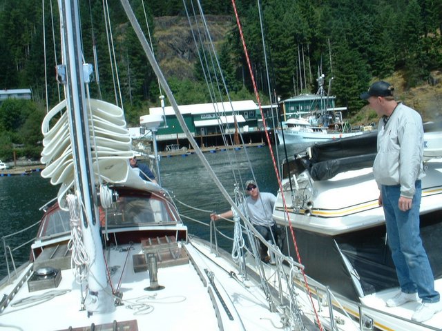
Yesterday a couple came in on a sailboat from the south; they had
recovered a skiff with engine,etc. This morning the owners, from Winter
Harbour showed up. Apparently the tow had broken near the Bar and it was
so rough that they couldn't turn around to fetch it back. They came over
today and said it was rough on the bar ( they were crossing not at
slack) but otherwise not too bad.
At Ralph's suggestion I gave them some firehose that we use for chaffing
guards to put on their tow line. They were grateful but we saw that they
didn't use it... i'm sure they can get back without our advice!!

We did another inventory of the staples/canned goods and re-orginized
them somewhat. We've made a collection of food that is in what is now
the "day locker". When that is used up, we'll restock it from the
storage lockers. That way, we don't need to be digging in 3 locations
for foodstuffs. Our ice is still holding up and we should be ok for
another 2-3 days. That is because it is too FREAKING cold to melt the ice!!!

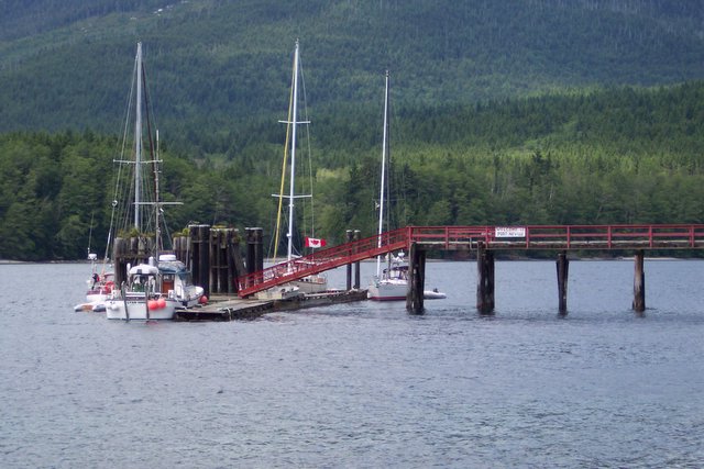
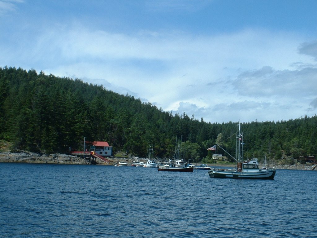
Stewart was able to convince Ralph to leave the boat for a hike ashore
to the village and to Roller Bay; while they were gone, I sat on the
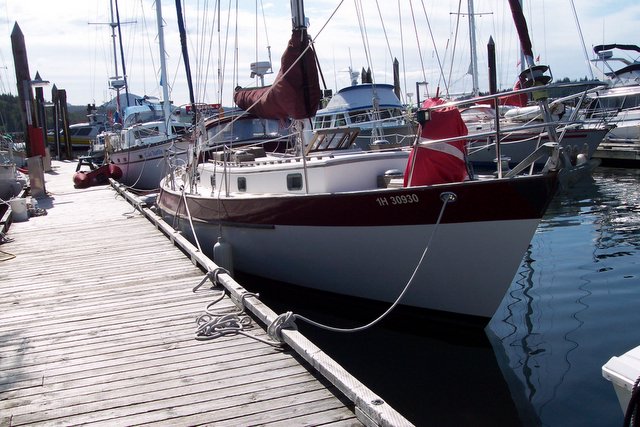
dock and did a quick sketch of the sailing/fishing boat that has been
our neighbor since we got here. The crew is father and son from Bella
Bella; he has been fishing the coast for 20+ years. They are off to
catch halibut and hopes to make $20,000 in 2 weeks. The boat is an old
classic built in Nova Scotia in 1952 ( same year I was built and same
year the skipper of the fishing boat was born). The boat is geared for
fishing and appears that accommodation/comforts are second priority; the
son was washing dishes in a bucket last night on the dock, so we suspect
that it doesn't have a galley/sink. They seem to be doing alright; i'm
sure they'll be a lot happier when the hold is full of halibut. The
fishing skipper thinks it is great that Tatoosh's crew have not killed
each other yet after so long waiting here!

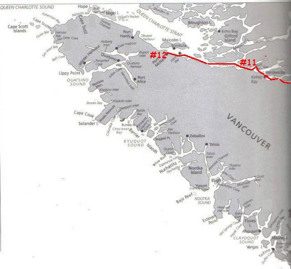
Next update will hopefully come with the news that we have rounded Cape
Scott and are in Sea Otter Cove. If all goes to plan we will be spending
Canada Day rounding Cape Scott.

Over and out from Bull Harbour, Hope Island.

PS: we are now regretting that we don't have satellite radio on board;
I'm having CBC withdrawal.

Thursday, June 29, 2006

day 17-18

We are still at bull harbour waiting for a decent weather window. It
appears to be moderating on this side of the island but there are still
gale warnings for the Northern End of the west side. There is an old
fisherman and his one man crew waiting to go up towards QC islands
fishing and they havent left either. He has been up and down these
waters for years so if he aint going neither are we!! His young crew was
tellling us that he was on the fish boat that sank and lost one crew;
captain didn't want to stop because he had a hold full of live fish that
he wanted to get to market.

I'm amazed at how quickly the day goes by without a whole bunch to show
for it. Yesterday we did some boat chores, each went our seperate ways
for walks,etc and were in bed by 10. This morning after coffee and bread
and a bit of a read, we ran the engine for an hour to charge up the
batteries. I was going to be clever and put some hot water into a
thermos to use to rinse the dishes but it was cold despite the engine
being hot.

When I checked, i found that the hoses feeding the hot water tank heater
were cold; immediately I went to worst case scenario: engine coolant
pump not working,etc. But since the engine was not overheating it had to
be something else. I suspected a clogged hose to the heater; I took off
hose after shutting down the engine and allowing it to cool. It had no
coolant in it but I could blow through it indicating no blockage. I put
it all back to gether, loosened the clamp on the hose while the engine
was running to confirm coolant flow; it now seems to be working. It was
likely a air GAP from the previous work on the heat exchanger.

After that I made a sat phone call to our Calgary coordinator to ensure
she was not worried thinking that we had left this a.m. to cross the
"Bar". The only upside to this weather delay is that each day, the time
of slack flow over the bar gets about 1 hour later which means more
sleep before we have to get up and leave.

An older couple came in and left a 16' aluminum boat they had salvaged
out on the channel; it has a large motor and fishing gear. Must have
gotten away from someone's dock.

Two questions that we need answers to that came up during the rambling
coffee discussions today:

1) is plankton a plant or an animal?
2) are fish divided up similar to mammals into fish that eat other
creatures (carnivore) and fish that only eat plants??

Over and out from Bull Harbour

Tuesday, June 27, 2006

day 16

Day 16:

Miles today: 15, all motoring.

We stuck to the plan and were off the hook at 06:50 with instant coffee
and peanut butter and banana sandwich. This timing would give us 2 hours
of a favourable current (albeit resulting in wind-over current
conditions but they were not too rough)

The wind had been blowing all night and the new forecast had upped the
ante predicting 20+kt winds by noon. We didn’t take any chances and
motored the whole way to Bull Harbour to ensure we were there in time.
Again, the wind was on our nose the whole way. About 1 hour out of Bull
Harbour we encountered a bit of ocean swell, so we are close to the
Pacific!

There were 2 boats taking shelter in Bull Harbour when we arrived and
another 2 arrived shortly after us. It is very windy in harbour so we
decided to tie up at the Native’s dock. This cost us 20/night along with
a $5/head fee to go ashore and explore. The woman who came to collect
our money was apologetic but said the Chief says that is the rule…fair
enough, as she said it is private land now.
Stewart and I went for a walkabout to the village and onto the beach on
the east side of this island ( Hope Island). There was a lot of wave
action on the beach and wind of course. We noticed a number of eagles on
the beach and when we got close we could see that they had been eating
on a carcass that had washed ashore. At first we thought it was an elk
or moose ( our Alberta roots showing again) since it had a large rib
cage and hair on it. Closer inspection showed that the fact it had
flippers ruled out an ungulate. Our next best guess is that it is a sea
lion.
There is something wrong with a beach walk that includes wearing toques
and gloves!!

There are no longer any ruins from the old Coast Guard station; some
building have been rehabilitated by the Natives, news ones built and old
sites have been cleared out. Families come here with their children,etc
for the summer; over winter there is a caretaker…. Must be a long winter
for them!

_Weather update: _winds are forecast to be 20-25 tomorrow and possibly
easing the next day. So we will be here for at least another day. The
weather down south in Johnstone Str. has been even worse; gales for the
last 3-4 days and today it is blowing 37 kts at Chatham point. If Ralph
and I had been delayed only one more day in Browns Marina with the
engine repair, we would still be there now waiting for the weather to
clear. We were so fortunate to have folks respond so quickly to our
problem.

_Problem update_:
The salt water footpump in the galley was not working because the
mounting had come loose. In the process of fixing this problem, I had to
take the fresh water hose from the 3-way valve. This valve allows the
foot pump to be connected to salt water (normal operation) or to the
fresh water tank as a backup if the electrical pump fails… a good idea.
What is bad is that the 3 way valve does not have mechanical stops and
it is possible ( I now know!!) to have it set such that the sea water is
partially connected to the foot pump and partially connected to the
fresh water hose. When Stewart and I returned from our walk, Ralph had
discovered water on the floor and looked to see that the freshwater tank
we had been using was now 100% full!! I tasted the water and sure enough
it was salt water. What had happened is that there was enough
hydrostatic pressure that seawater was forced through the partial
connection into the starboard water tank.
This meant having to drain the starboard tank, connect to the port tank,
flush out the salt water. I removed the fresh water connection to the
footpump, and plugged the 3 way valve outlet to ensure that even if it
moved due to boat bouncing around that it would not leak.
One plan was to negotiate with the natives for some fresh water; we used
the sat phone to call Winter Harbour and confirm that we would be able
to fill up with water there.
So we are back together with one full water tank, functioning salt water
pump for non-drinking use and an empty spare water tank.

This arrangement of the piping has to be fixed. I’ll add yet another
TODO item to replace the valving and do it properly. I can’t understand
why anyone would have designed a system that would allow for that
possibility.
The positive spin on all of this, is that since this trip is also
serving as a shakedown before a first offshore trip, it is succesful so
far.

Seems like the SKIPPER has been the biggest problem so far!?!

Monday, June 26, 2006

Day 15 - Port Alexander

Day 15:

Miles today: 25

Anchored at Port Alexander, a semi-protected inlet on Nigei Island

N50-51.43/W127-39.93

We left Port Hardy at 08:20 bound for Bull Harbour. It appeared that we
had a weather window until late afternoon when winds were forecast to
build to 25+kts. Tomorrow is doubtful for going around the end due to
forecast gales at the north end, but at least by being in Bull Harbour
we would be poised to go when the weather settles down. Plan B was to
make a call as to whether to continue when we were opposite Port Alexander.

On our way out we did not see either the humpback whales or the orca pod
that were reported to be in Hardy Bay

We started with one reef in main and ended up with 2 reefs in main and
the staysail only ( this is smaller inner foresail) with winds in the
20-25 range. The boat was comfortable with this sail combination. We
were doing 5-6 kts without having to fight at the helm. However the wind
had shifted enough that it was right on our nose and we were tacking up
Goletas channel and not making as much headway as we hoped.

It is only 22 miles on a straight line course from Port Hardy to Bull
Harbour; we bailed out at Port Alexander after 5.5 hours. It was 13:30
and winds were gusting 25+ and forecast to build so it was not a
difficult decision to head into Port Alexander to anchor for the night.

We put on 22 miles to go about 12 miles along the course line! Of course
the alternative would have been to motor but motoring straight into the
teeth of 20-25kt winds would not have been a good time.

The shore in here is “steep-to” meaning that it shallows quickly
potentially making anchoring less secure since it is on a slope and not
on relatively flat bottom. So far we seem to be holding whenever we are
hit by a gust of wind. Although it is called Port Alexander, there is
nothing here.

For anyone wanting to escape the boating “crowds’ in the Gulf Islands,
this is the place to be. The commercial traffic far exceeds the cruising
boats and civilization is far and few between. Some might argue that
even the “civilization” is not so civilized!

Skipper didn’t have his sun hat tied down well enough and we lost a ½ hr
recovery the “hat overboard”. Supper tonight was turkey cutlets, steamed
potatoes, corn and salad with banana pudding with bananas.

Plan for tomorrow is a repeat of today; get away in morning before winds
build and finally reach Bull Harbour and wait for our weather window to
go around Cape Scott.

Day 13-14

Day 13, June 24.

Miles today: 25

Miles to go to Port Hardy: 0!

We left Port McNeil at 09:00. I was concerned about how we would be able
to get out of our dock spot; Tatoosh has bad prop-walk to starboard when
in reverse and we needed to back out to leave here. This was compounded
by the fact that we had limited clearance on the way out between boats
(about 2’ each side if that)

In any event, it was uneventful; we sprung off the bow, allowing aft end
to swing out into the channel and we calmly backed out with any shouting
or hitting of other boats!!

The water was completely flat until about 5 miles outside of Port Hardy
bay; since we were going in it was hardly worth the effort to raise
sails for 40 minutes of sailing.

On the way in, we saw a grey whale leisurely making his way back out to
sea. Other than some porpoise today, this was the only marine wild life
we have seen. Near the marina there are eagles galore, flying around and
eating whatever it is they eat at low tide on the shore. At one point we
could see 6 eagles in the air here.

We had to stand station for 15 minutes while the marina made some space
for us; another tight spot between 2 other boats..made worse since it
was on our port side ( This is not our favourable side to dock to since
prop walk drags our aft to starboard..hence making a port-side docking
difficult because when you go into reverse to slow down , the back of
the boat will start moving away from the dock. On a starboard side
docking, the opposite happens and when going into reverse, the back end
will move towards the dock, making the docking easier.)

On the dock was Stewart; already here and waiting for us. He beat us by
mere hours. So, despite the scheduling set back of the engine work in
Browns Bay, we arrived in Port Hardy at the same time as stewart; and
now Leg #1 is officially over, with total miles travelled of 286.

Later when talking to Robin who reminded me of the need to keep the
satellite phone charged; I remembered that I didn’t have the charger!.
After calls back and forth, it was found in the box of stuff that was to
come out by car; I forgot to tell Robin to include the charger with the
care-package for Stewart to take.

Before we organized to have Robin send the charger by FedEx, Ralph
recalled seeing a shop that sold electronics and sat. phones. We decided
to walk up and see if they were open tomorrow (Sunday). To my surprise
they were still open AND turns out they had a proper charger for the sat
phone. So, we now have a charger for the sat. phone and are good to go.

Appears that the wind with be stronger tomorrow so we will likely stay
here until Monday. This will give us a chance to do some boat clean-up,
chores and food purchasing, etc.

Day 14: miles 0

We are waiting for a weather window and will not leave until tomorrow at
the earliest. Boat has been cleaned up; fenders pumped up, small
electrical problem with autopilot is fixed and there is nothing left to
do but final shopping and watch the eagles battle with the local crows.

Over and out from Port Hardy.

Sunday, June 25, 2006

Day 13-14

Day 13, June 24.
Miles today: 25
Miles to go to Port Hardy: 0!

We left Port McNeil at 09:00. I was concerned about how we would be able to get out of our dock spot; Tatoosh has bad prop-walk to starboard when in reverse and we needed to back out to leave here. This was compounded by the fact that we had limited clearance on the way out between boats (about 2’ each side if that)

In any event, it was uneventful; we sprung off the bow, allowing aft end to swing out into the channel and we calmly backed out with any shouting or hitting of other boats!!

The water was completely flat until about 5 miles outside of Port Hardy bay; since we were going in it was hardly worth the effort to raise sails for 40 minutes of sailing.

On the way into to Hardy Bay, we saw a grey whale leisurely making his way back out to sea. Other than some porpoise today, this was the only marine wild life we have seen. Near the marina there are eagles galore, flying around and eating whatever it is they eat at low tide on the shore. At one point we could see 6 eagles in the air here.

We had to stand station for 15 minutes while the marina made some space for us; another tight spot between 2 other boats..made worse since it was on our port side ( This is not our favourable side to dock to since prop walk drags our aft to starboard..hence making a port-side docking difficult because when you go into reverse to slow down , the back of the boat will start moving away from the dock. On a starboard side docking, the opposite happens and when going into reverse, the back end will move towards the dock, making the docking easier.)

On the dock to lend a hand was Stewart; already here and waiting for us. He beat us by mere hours. So, despite the scheduling set back of the engine work in Browns Bay, we arrived in Port Hardy at the same time as stewart; and now Leg #1 is officially over, with total miles travelled of 286.

Later when talking to Robin who reminded me of the need to keep the satellite phone charged; I remembered that I didn’t have the charger!. After calls back and forth, it was found in the box of stuff that was to come out by car; I forgot to tell Robin to include the charger with the care-package for Stewart to take.

Before we organized to have Robin send the charger by FedEx, Ralph recalled seeing a shop that sold electronics and sat. phones. We decided to walk up and see if they were open tomorrow (Sunday). To my surprise they were still open AND turns out they had a proper charger for the sat phone. So, we now have a charger for the sat. phone and are good to go. Another expensive ommission by the skipper.

Appears that the wind with be stronger tomorrow so we will likely stay here until Monday. This will give us a chance to do some boat clean-up, chores and food purchasing, etc.

Day 14: miles 0

We are waiting for a weather window and will not leave until tomorrow at the earliest. Stewart is now offically on board, Boat has been cleaned up; fenders pumped up, small electrical problem with autopilot is fixed and there is nothing left to do but final shopping and watch the eagles battle with the local crows.


Over and out from Port Hardy.

Friday, June 23, 2006

Where we are now!!

 
As you can see, we have moved onto the "north" map, we have passed the 250 mile mark of "leg #1". We will be in port hardy tomorrow which marks the end of "leg #1".... greetings from the internet cafe, conviently located at the Haida Way pub!!! Posted by Picasa

The route map"!!..

 
I forgot to put this in the proper sequence...oh well! Posted by Picasa

Port McNeil

 
Here we are with our 41 feet (including anchor) tucked into our 44' opening. Not sure how we'll make out leaving it in the morning'!! Posted by Picasa

Johnstone Straight: calm day

 
Our first calm day on Johnstone Straight; enroute to Port McNeil Posted by Picasa

day 12

Day 12, June 23, 2006

Miles today: 41

Miles to go to Port Hardy: 20 miles, approx.

Docked at Port McNeil

We left early, again, getting away with a neatly executed aft spring to
get the bow turned into the current to avoid rubbing against the old
oily pilings. We were underway at 06:20 with another breakfast of
champions, instant coffee and a banana.

The sails were up for a grand total of 20 minutes.

It was an uneventful motor up to Alert Bay. We passed by Robson Bight (
THE place to see killer whales) and not a whale in sight.

We were arriving earlier than expected due to some current boost and
when we scoped out the harbour by binoculars, we realized that we had
been here when we sailed on the Mahina. We decided to continue on up to
Port McNeil.

The guide book recommends refuelling here rather than Port Hardy since
fishing boats get priority at Port Hardy and you may end up in a queue.
After fuelling we gingerly made our way into a long narrow finger to our
berth, a 44’ opening between two other boats in a dead end finger. We
managed it without hitting anyone, especially the boat behind us with a
bowsprit protruding over our aft section, and without shouting at each
other. Leaving will be more difficult especially if there is any wind at
all.

The town has that unique B.C. eclectic mix of nicely done stuff, garish
and the downright junky. Other than an art gallery with some really nice
native art, there is not much to see other than the spectacular view
across Johnstone Str. We can see Sointula from here, which would have
been another choice; as I keep saying now, “next trip”..can’t do it all
in one trip.

For some unknown reason one of the “must see” things here is the new
Laundromat, complete with CNN on TV and free wireless internet access.
We will go there shortly to upload this stuff. I’ll take advantage of
the internet access for the computer ( as opposed to being able to only
use a terminal) to upload more photo’s than normal; it is much easier
when I can connect the computer to the internet directly.

Tomorrow will be relatively short day, and rendezvous with Stewart.
We’ll need to do some boat chores/cleaning and shopping before we decide
on departure day. That will also depend on what the weather is doing.

day 11

Day 11: June 22 – Where’s the latte?!?

Miles today: 31

Location: N50-29.57/W126-05.27

Miles Left to Port Hardy: 59

The weather reports for Johnstone Str. seem to be more accurate than
what we are used to in the Gulf Islands. As predicted, the wind
strengthened in the evening and were up again in the morning. The
morning forecast was for 10-20 kts and building to 25-30 in the afternoon.

We weighed anchor at the ungodly hour of 04:50; this gave us a longer
time with a favourable ebb current, although a favourable current means
rough wind-over-current conditions for the constant NW wind. We put up
the main before we turned into the straight and were immediately in
rough wind over current conditions. The seas were steep and close
together. They slowed us down by about 2 kts ( with the current we
managed to average over 6kts for the day) and we were taking spray in
the cockpit. We headed to the nearest refuge on the north side of the
Straight, into Knox bay to put in a reef. We also hanked on the stay
sail in case we needed it and deployed the safety lines (Jack lines). We
didn’t need either but better to do it in calm conditions than out in
the wind.

Because it was rough and the wind was right on our nose and we needed to
get past Race Passage before the current changed to flood, we motor
sailed rather than trying to tack against the wind.

We got into Port Neville and found a spot at the small dock at 10:20.
The winds were forecast to continue to build up to 30kts in the
afternoon, so we called it a day and had an early lunch and a snooze. We
are out of fresh protein so tonight will probably be Kraft dinner and
tuna fish or some such concoction. Lunch was ham and bean soup augmented
by first frying some onions and diced ham before adding the soup. It was
a lot better than our breakfast: instant coffee made with water boiled
last night so that we didn’t have to fart around with the propane in the
morning. This was augmented a hour later with a peanut butter and
blueberry jam sandwich.

In deviance of the ship’s articles regarding walking, Ralph stayed on
board when I went for a beach walk. I ventured up a steep hill into a
section of old growth forest. I found a “path”… at least it was an
animal path. I knew this because I saw the bear shit. I circled back
towards the home sites and was feasting on wild raspberries that were on
the path when I thought that standing in waist height grass eating
raspberries on a bear path probably wasn’t very smart. Especially when
the old post office store has a hand-printed sign saying “Beware of
bears -a very close”! I had an uneasy feeling and cut my walk short.

All that is left of Port Neville is a sturdy looking old log store; the
building style is Scandinavian. The guide books says that the widow and
daughter of Ollie still live here. (The Hansen family ran the store from
1924 until 1960 when it closed due to lack of customers) However, on my
ramble I stumbled across a simple grave site which had the grave of
Ollie’s widow, Lilly, who died in 2003. So it is obviously only the
daughter living here now.

There are a lot of ruins in the woods and obviously Port Neville was a
lot busier than it is today!! I knocked at the still functional Post
Office, but no one answered; I didn’t persist because it was near lunch
time ( at least lunch time for people who don’t get up at 4:30!)

We plan on repeating today’s timing for an early getaway to maximize the
time we have a favourable current.

PS: the daughter, Laura, came down to introduce herself at about 9:30
this evening and offered to open the store and show us around. She asked
if had seen the grizzly bears that have been on the beach and harassing
her; they had to fire a noise cannon at them earlier this afternoon!! …
seems they are after the local deer fawns. When I mentioned that I had
gone for a walk up the hill and into the raspberry patch, she looked a
bit alarmed!

She told us that one doe has been here for 14 years and it can be hand
fed. She herself has lived here for 55 years! The house she lives is
another log house built in 1935 and looks brand new. It even has a full
stone walled basement.

I asked about the grave site and she says they had a ceremony here last
year with relatives and friends to intern the ashes of her mom and an aunt.

I bought an official Port Neville t-shirt and Ralph bought a water
colour by the artist that lives across the bay.

Apparently some times she organizes pot lucks with the various boaters,
etc. I would love for Robin to have seen this place and to meet the owner.

Early to bed since we will be rising early once again.

Old Port Neville

 
Another old floating shop of some kind. Posted by Picasa

Old Port Neville

 
One of the many pieces of evidence that Port Neville was once more than it is now. Posted by Picasa

Wind is up again

 
Even in harbour you can see that the winds have built up late in the day as predicted...they were 20kts at Fanny Island ( PS: that is us on the outside) Posted by Picasa

Late afternoon winds up again

 
even in the harbour you can see that the winds are up over 10 kts; they were measured at 20 kts at Fanny Island at this time...good thing we were in harbour. Posted by Picasa

Artsy photo

 
An old large shackle used to tie log booms together. Posted by Picasa

What bears?

 
A sign I should have paid more attention to...or not. In any event, I didn't see the grizzlies that were prowling the beach while I was out on MY beach walk. Posted by Picasa

Port Neville

 
This is obviously the old post office/store at Port Neville; still in great shape and now used as an informal museeum and gift shop. I'll post a few other photos from Port Neville after this one. Posted by Picasa

Chatham point-- another milestone

 
This is the Chatham point lighthouse on the point of the junction between Johnstone straight (to the left) and Discovery Channel ( up from the south from Campbell River) Posted by Picasa
 
This is the view out of Browns Bay Marina; past the old tanker cars now functioning as a breakwater! Posted by Picasa

day 9-10

Day 9 -10 “On the Road Again!”

Day 9 was spent doing boat chores, updating blog site, shopping and
cleaning since the mechanic would not be out until early tomorrow.

We must be the biggest thing to happened to the marina so far this
season; everyone walking the docks just doesn’t say “hello”. They
obviously want to talk and invariably the opening statement is something
to the effect “ how is your motor coming along?”…so everyone seems to
know we were the guys towed in with engine problems. This is also the
first time that I’ve ever been in a marina where we were the only
sailboat; everyone else here is a pleasure fishing boat or some kind of
working boat.

It was easy giving directions to the mechanic; just go to “the sailboat”.

The results of testing the heat exchanger were inconclusive in that it
checks out o.k. So, the only culprit appears to be a clamp that came
loose on the exchanger core allowing coolant to escape into the exhaust
water.

Day 10:

Miles today: 12

Miles to go to Port Hardy: 90

The engine was put back together, load tested on dock by motoring
against the dock lines and all seems o.k. We used our spare thermostat
so I went back into Campbell River with the mechanic to pick up a new
one; the staff kindly drove me back out to the marina. We did another
load test for almost 1 hour to assure ourselves that all was o.k. and
that we were not loosing fluid.

I cleaned up the engine room and bilge, ensured that we have more than
enough coolant if we need it and we left at 14:45 to catch the turn to
ebb. We dropped anchor at Turn Island, just at the junction of Discovery
Channel and Johnstone Straight at about 17:00. Weather forecast is that
winds are to start out light and build in the afternoon and evening,
getting up to 25-30 kts. by evening ( pattern is almost the opposite of
the gulf islands where the wind dies in the afternoons).

Our plan is to get up early and be underway by 05:00. We have water
boiled in the thermos ready to make instant coffee; up anchor and
away!..yikes. We have to make Race Passage before noon else the current
will put us at a standstill. We will go until the wind builds; hopefully
we can make it to Port Neville ( which is now an abandoned post office
and art galley) across from Kelsey Bay or even beyond if weather holds.
That will put us within striking distance of Port Hardy.

Tuesday, June 20, 2006

The TOW

 
This is after we made it through the entry in the breakwater ( which is a string of old sunken railway tanker cars..not something you want to hit!) We are at the fuel dock getting tied to gether so that they can manouver us into a slip. turns out we just made it as his power boat developed engine problem when he was trying to dock himself after getting us secured. Posted by Picasa

Kanish Bay - small inlet

 
This is our anchorage inside "small inlet" at Kanish Bay Posted by Picasa

Seymour Narrows

 
For the record, this is the actual narrows; ahead is Discovery Channel Posted by Picasa

Seymour Narrows

 
This was some of the traffice overtaking us at the Narrows. Posted by Picasa

day 8

_Day 8: “minor disaster day”._

Total miles for today: 11 miles, 9 of which are backward!!

We weighed anchor at 08:40 and were motoring out of ‘small inlet’ and
traversing Kanish Bay when I noticed that the engine temperature gauge
was at maximum. We immediately shut down the engine. It was obvious from
the smell coming up from below that this was a real problem and not a
problem with the gauge.

Before we got to troubleshooting, we raised the sails to ensure we were
not pushed onto the rocks by the flood current( i.e. south going in this
part of B.C.). When I got opened the engine room door and the smoke
spewed out, I immediately thought the engine was trashed. However, I
quickly went through the logical troubleshooting sequence:

Ø sea water (cooling water) inlet strainer was not plugged

Ø low cooling water flow alarm had not sounded

Ø removed cover to raw water pump and checked impellor. ( thank goodness
for the recently installed SpeedSeal cover)

Ø Opened sea cock and confirmed water was getting to raw water pump.

Ø Checked engine oil to see if antifreeze was in oil ( this` would be a
really, really bad sign..cracked head or bad head gasket) but seemed O.K.

Ø Let things cool before I tried to open the cap on the heat exchanger;
once it was open, I could see that there was little to no antifreeze in
the exchanger.

Quick Aside for the readers who are non-boaters: the heat exchanger is
similar to a radiator on a car. The difference is that on a car, air
flowing through the radiator takes away the engine heat absorbed by the
coolant ( antifreeze). On a boat, sea water ( raw water) is used to pass
over tubes carrying the coolant and the raw water picks up the engine
heat ( hence the name “heat exchanger”). The hot sea water is mixed with
the engine exhaust and it goes out the boat back into the sea.

I refilled the exchanger and tried to start the engine, which it did. At
least the engine was not seized and there seemed to be raw water being
expelled out the exhaust ( a good sign- raw water pump is working and
there are no obstructions). We immediately shutdown to ponder our
options; 3-4 litres of antifreeze is missing; no sign of it in the bilge
or in the engine oil…. So it must be the heat exchanger leaking and
sending it out with the hot exhaust water.

There are no facilities to the North, so we gybed and starting sailing
back towards Campbell river. We would have had some challenges in trying
to sail through the narrows, with traffic and possibly a counter current
if we did not make it in time for slack. On the way up, I had noticed a
small marina just north of the Narrows; if they had space, we could duck
in there for repairs. It would mean a 20 km trip by road to Campbell
River, but at least we would be positioned further north and more
importantly north of the Narrows. This would give us flexibility in
leaving without worrying about slack times.

The next part of this story illustrates my theory that most people just
want to do the right thing when it is needed.

After reaching Brown’s Bay marina on the VHF radio and explaining our
situation; I asked if there would be someone there to help us once we
sailed into the marina. The marina operator told us to take our time
arriving and give him ½ hour. Within 20 minutes he had organized a
fishing boat to come out and tow us in. After we were docked, I asked
the boat crew and skipper, Lee (from Ripple Rock RV park) what I owed
them and they said nothing, just “pass it along and help someone else
sometime”. I offered to at least buy them lunch but they said they had
to get back to work.

When I went to check in at the marina office, the manager offered us his
phone to contact a mechanic. When I then asked the marina manager what
the moorage rates were, he said “you don’t pay if you are broken down”.

The service manager at Altech Mechanical said he’d rearrange his
mechanic’s schedule to be sure he got out to see us before 2 pm( he
arrived at 13:30)

After working with the mechanic from Altech and doing pressure tests,
etc he came to same conclusion that it had to be the heat exchanger
although there was no obvious problem other than there was a slightly
loose clamp that may have allowed coolant to escape into the exhaust
water. I told him I wanted to be sure before we took off further North
and he agreed to take the exchanger into the shop for proper testing. We
had organized for a rental car in Campbell River and asked if he had
room to drive us into town, which he agreed to. When he got to the shop,
he told us to wait and someone from the shop would drive us the last 8
km to the car rental.

Before we left, I asked the marina manager what Lee’s favourite drink
was and he said he is a Budweiser man. On our way back with our rental
car, I picked up 2 24 packs of Bud for Lee and a bottle of Crown Royal
for MANAGER to show our appreciation. I’m going to write a letter to the
local paper as well; we were both overwhelmed at how well we were
treated by everyone.

The happy ending to this story will be that there is no major mechanical
damage on the engine. We will find out tomorrow afternoon when the
mechanic returns.

PS: Ralph has accused me of executing a very devious scheme in order to
be somewhere to watch the final game of the Stanley Cup…which ended
badly. There should be a ban against any city having a hockey team that
comes from an area that does not have any natural ice in the winter.

Day 7

Day 6/day 7:

As reported previously from the internet café, we spent Day 6 completing
a short motor across from Cortes to Campbell River in time for slack at
Cape Mudge. Weather is building for the next day which would mean that
if we carried on, we’d likely be turning the corner into Johnstone Str.
with 20+kts of wind on the nose, against an ebb current; worst possible
conditions. Plan A is to stay here for another day. Plan B is to leave
early tomorrow to get past Seymour narrows and anchor north of the
narrows and wait there for good conditions; without having to worry
about slack at the narrows.( this was Robin’s suggestion which hadn’t
occurred to us – she is now acting as our “weather router”!).

We did a power shopping at the local grocery store; entered at 09:45 and
were out before it closed at 10:00!!

Next Morning – Day 7: we ate, topped up fuel and water and were underway
by 09:30 enroute to Seymour Narrows. We arrived 5 minutes before we had
planned to be there; having to jockey position with 3 south bound
barges, a large North bound barge that passed us and a large freighter
that passed everybody! The computer-as-chartplotter works well for this
sort of thing; you can adjust your speed and monitor your ETA to ensure
you arrive at the proper time for slack

As predicted the wind picked up once we were through the Narrows. The
narrows are about ½ mile at the actual narrows and Discovery Channel up
to Johnstone Straight is about 1 mile wide. This isn’t much and when you
understand that more than 1/3 of the tidal water flow to fill the entire
Georgia Straight passes through here, it is easy to understand how this
piece of water can get rough and why it gets the respect that it does.

It was so cold that I finally gave in and put on socks, having had to
give up on wearing shorts a few days ago. I ended up wearing a toque,
socks, 2 jackets and a neck warmer…this is worse than fall sailing. When
is summer supposed to get here??

We went into Kanish bay at the end of Quadra and further up into “small
inlet”. This is a hard to see, narrow entrance that has 2 meters of
water at 0 tide. Once inside it is indeed like a lake as described in
the book. Feels like a spot you could spend a few days on a reading break.

Ralph broke out his fishing gear to try to cast for some “rock” fish;
not sure what they are but I’ll let you know when I see one…so far,
score is Fish 1 , Ralph 0.

Unfortunately there is no cell phone coverage so I screwed up and was
not able to reach my Dad to wish him happy father’s day. I had also been
unable to call my Mother on her birthday.

We are anchored at N50-15.5/W125-17.1. this is the furthest North
Latitude that Tatoosh has seen.

Total Mileage for today: 19, total for trip so far, 168. Miles to go to
Port Hardy, about 100.

Saturday, June 17, 2006

Day 5-6 Map


I think I have this process figured out; if so, here is the updated route map.

cortes Bay


here is photo of Cortes Bay; not much here other than the Seattle Yacht Club outpost and the Van. Yacht club outpost. Seems strange that there would be so little settlement or commercial activity. Must be a story there somewhere.

Day 6


quick update since we are online and paying by the minute.
we made an uneventful, motor trip over to Campbell river; got here about 11:30. After some confusion about the slip we were supposed to be in, we had to spend 1/2 hr warping Tatoosh over to new slip.

Hopefully this stuff works, trying to upload some photos and maps but it doesn't seem to be working.

Impression of Campbell river is one big shopping mall! I'm sure if we got out further we'd see some of the "old" town if it exists. Tomorrow we need to time our getaway so that we make slack at the infamous Seymour Narrows. More on that after we get through

we were unable toget CBC radio forthe past 2 days and I was surprised tosee that Edmonton is still alive and well! We got a Globe and Mail for a treat and will eke it out over the next few days.

We don't need many groceries so we will have a short shopping trip and will be ready to go. We may top up the fuel since we are told this is the cheapest diesel on the Island ( about 93 cents/litre).

cheers for now,
Bruce & Ralph

Day 5

Day 5: Still at Cortes Bay!
Days mileage: 0.0

Weather forecast was not good, but we could leave as late as noon and still be past Cape Mudge before flood developed into “wind over current” which is highlighted in RED ink on the chart as being very hazardous conditions; verified by every guide book! This meant we could sleep in and leave by noon to still make it past Cape Mudge.

At noon, readings from Sentry shoal buoy showed winds at 20 and gusting higher. Winds at Cape Mudge were over 25 kts. There were still waves crashing outside of the entrance to the bay and the trees were moving more than they were when we came in yesterday. So, the decision was made to stay put for another day.

One highlight of the day was getting the navigation table cleaned out and organized. I found a few things I didn’t know I had and made some sense out of the storage. Was able to also set it up to take all of the usual charts we would use in a week or so, so they are handy.

I couldn’t convince Ralph to come with me for a walk on shore (Rhoena – I tried!!), so it was a solo trip. It was also the first official use of the outboard motor. I got underway and the engine quit about ¾ of way to the wharf. I rowed back against swell and wind wondering how the hell it could be out of gas already. As I approach the boat, Ralph quietly asked if I had remembered to open the fuel shutoff. Of course I hadn’t, so I was off again. So now I know how far we can go with a carburetor’s worth of gasoline… about ¾ of way between us and the wharf! Life seemed a lot simplier without the outboard motor.

At the wharf I spoke with 2 fishermen just coming in. One said it was the roughest he has seen since he moved here four years ago. So we had made the correct call to stay put.

I walked towards Manson Landing, not sure how far it was. I had at least 3 offers of rides but explained I was exercising my boat legs. About half way along I came by a farm with a decidedly mean looking pit bull who was eyeing me as I went by and was slowly making his way to the end of the drive whenever I didn’t look at him. I found a large stick up the road to pickup for the return trip!

I had decided to wear my running shoes with no socks (can’t think why I didn’t just take along my sandals). In any event, when I arrived at Manson’s Landing I was in time for the eclectic farmer’s market. Unfortunately I had not brought along my wallet. I stopped to retie my shoes and saw that the back of my runners were soaked in blood… that is why my feet hurt…how stupid can I get?? ( I’m sure we’ll find out before the trip is over).

I took the first offer of a ride on the way back without even a hint of feeling wimpish.
The trip back against wind and swell under motor was a lot easier and faster than the previous one I had just completed under oars. So, I guess the motor will stay on board for while. Once back on board, we organized the charts into the next chunk we need to finish Leg#1 ( i.e. get to Port Hardy) and the chuck for the west coast.

For dinner we “had” to cook the steaks we had bought in Sidney, they had thawed a day ago and were ready to cook. Ice is low so we will be ready for a pit stop tomorrow in Campbell River. Hopefully I can find an internet café and get these updates off to the blog site. No cell phone coverage so no calls back to the home front either.

Over and out from Cortes Bay.

Day 4

Day 4: Anchored in Cortes Bay: N50-03.7/W124-55.8

Today’s run: 49 miles
Total so far: 131. About 160 left to go to Port Hardy.

The original plan ( i.e last night’s plan) was to leave relatively early and head for Copeland Islands near Lund. Getting up early was not a problem since I hardly slept and was awake to hear the ship’s bell for most of the hours! Turns out that with the prevailing wind last night, this bay gets reflected waves/swell into it or at least the combination was right last night. I’ve been here twice before and don’t remember this happening. At any rate, it was like being in ferry swell for most of the night. At breakfast I apologized to Ralph for any crankiness that I would exhibit during the rest of the day.

Just before making the turn towards Lund near Savory Island, the updated weather was forecasting 30kts winds overnight and the Copeland anchorages are described as fair weather anchorages. We decided to go to Cortes Bay; it was only another 8 miles and is closer to Cambell river ( tomorrow’s destination) than we would have been at Copeland Is.

Today was a sailing repeat , for the most part, of yesterday, except for bigger winds. It was all downwind, but for the final finale into Cortes. By late afternoon we had 2 reefs, in over 20 kts. We were consistently doing 7-8 kts over ground. When we turned the corner to make final approach to Cortes, we were close-hauled in winds gusting to 25kts and took a bit of green water over the bows! Found out there is still a minor leak that drips onto nav station… potentially not good news for Ralph as his laptop was running as chart plotter at the time. This meant shutting it down just as we were trying to confirm the entrance to Cortes Bay. It is well hidden!
Good thing we had paper charts. As is often the case, this is when the depth sounder decided that to start reporting 0 feet!... it does this occasionally, due to either junk in the water or temperature layers in the water. At any rate, it is a bit disconcerting when you are making an approach to a entrance ( at extreme low tide) when the Coastal Pilot says “..entrance is extremely shallow and narrow….”

Repairs made today:
- flag pole metal mounting sleeve re-glued ( if I hadn’t noticed it we would likely have lost our flag!)
- re-mounted brackets for wheel/binnacle water bottle holder ( had come loose)

Boat speed indicator is now working ( after yesterday’s cleaning) but still has same problem as last year: still reads low. There is obviously some kind of restriction in the wheel. I will try to find out if I can input a different conversion number and get it back to close to normal. This will require checking it against the GPS when we are certain there is no current effect ( or at least know what the current is and subtract it out) I’m sure the “geek patrol” will be able to work something out.


One hour on the engine today and 0.9 yesterday so last 2 days have made up for first 2!

Day 3

Day 3: At False Bay, Lasqueti Island

Bad news is that Robin will not be joining us for Leg 1, she may get out and join up with us at Toffino on the west coast.

We had a late departure from Schooner Cove to allow us to do our laundry. We got away about 11:40, by when wind had picked up and clouds had moved in. The wind was gusting up over 18 kts with steady wind around 15. We were sailing more or less downwind. We hit Speed over ground of 9 kts so we were likely close to 8.5 kts boat speed. ( knot meter not working..yet).

We managed to sail right up to our anchorage without having to tack or gybe once; we were on the hook at 14:15 It was a much quicker sail than we had planned so that gave us a leisurely after noon on the hook…so we thought. The Lasqueti “sailing” club was out in full force; 2 very old hippy types out on wind surfers and some other outs driving in noisy, endless circles with their Seadoos. I am not only getting old, I’m getting cranky!

The binnacle teak water bottle/stuff holder broke after taking a hit during our bouncy ride across the Straight; I managed to knock the bottom out of my fancy new book rack I had built during the winter by dropping a heavy volume into it and the knot meter had not magically cleared itself. The extra time on anchor was spent repairing the woodwork and then pulling out the paddle wheel, cleaning and replacing it. The aftermath of pulling and replacing the paddle wheel is dealing with the 2 gallons of sea water that gushes in when the wheel is removed from its spot in the bottom of the hull. It is about 1.25 inches in diameter and it is a sobering sight to see the water rush in from such a small hole – thinking about a larger unplanned hole doesn’t bear thinking about. The unplanned “benefit” of this operation is that most of the cabin sole has been washed in salt water, then rinsed in fresh water ( along with my pants!)

Tomorrow’s plan is to head up and be in position to make slack at cape mudge to get to Cambell River. That in turn will position us for making slack at Seymour Narrows. The anchorages on this portion of the main island are few and far between. We plan to leave here and make for an anchorage near Lund.

Dinner tonight, courtesy of Ralph, was pork chops in tomato sauce, noodles and green beans. We topped that off with a no sugar, no fat, instant pudding with some real bananas added.

Skipper still hasn’t been able to repair is shoulder and wrist…. Perhaps more beer will help!!
With the Stanley Cup finals and World Cup soccer going on, a boat satellite TV suddenly doesn’t seem such a bad idea!!.. or at least satellite radio receiver for using in the boat and the car….

I am still getting my “sea legs”. Almost got a hard shot on the head from a swinging boom, luckily I saw it coming out of the corner of my eye and ducked in time….could have been a short trip for me at any rate.

Day 2


Day 2: -
At N49-17.2/W124-08.04 “Fairwinds Resort Marina”

We left Princess Bay and motored up to Gabriola passage for slack at 12:13. We transited at about 12:10 so timing was not so bad! We then went out to Straight of Georgia and finally were able to raise the sails in about 10kts of wind.I get annowyed with having to be running the engine to the point it is almost irrational. It was downwind sailing and we were averaging about 4 kts.

The plan was to either go to downtown Nanaimo, Fairwinds(schooner cove marina) or Lasqueti Island. Lasqueti was too far given our slower progress by sail so we opted for Schooner Cove.

Nothing of note underway, other than we seemed to miss out on what appeared to be extensive rain showers on the island.

I had tried to reach my sister Lori but was only able to leave a message that we may be in Schooner Cove. When we arrived, we had been given our berth by VHF but Ralph pointed out a women waving at us and I assumed it was a marina worker. It wasn’t’ until we had berthed that I realized it was Lori, I was so intent on getting us docked without a rodeo.

She invited us over for dinner with her and husband Kelly; we had a great dinner, watched some soccer updates and basically did an “eat and run” and were back at the boat by 09:30 p.m. Ralph was able to cleverly able to dodge his day as “cook”.

Day 1


Day 1: Leaving Canoe Cove


Ralph and I left Canoe Cove at 13:20, without Robin. She has not yet decided if she will make the trek over for the leg up to Port Hardy; current plan is for us to start up and she may meet us in Nanaimo or further up.


We had to finish up some last minute stuff on the boat ( bolt cutter paint finally dried so it could be stowed and cleaning of anchor winch). We took bus into Sidney to get fresh groceries ( and not to forget our frozen meat stash!) returning via taxi.


No rodeos as we left, just off a "zero" tide ( almost as low as the tides would ever get). This meant that we would have the flood tide with us all the way. We headed up towards Trincomali Channel with no wind to speak of. There was also no wind in Trincomali itself and we ended up motoring all the way. As befitting a "geeks go sailing" theme, we had 3 portable GPSs and the ship's onboard GPS all turned on at one point to confirm that Ralph's #1 (of 2) GPS was incorrect ( turned out it was reporting in statue miles and not nautical miles)


We decided to anchor in Princess  Bay at the north end of Wallace Island. There are 4 other boats here and we are dead centre in the channel. Weather report indicates that there MAY be some wind tomorrow and chance of showers this evening. As I write this up, I am now hearing the lazy jacks banging against the mast because I forgot to tie them off ( it takes a day or so to get back into the routine habits) so perhaps we will get a bit of a blow this evening.


Dinner tonight was a one pot special of burgers layered with sliced potatoes, onions and mushrooms. Salad, wine and rice pudding finished the meal. It was good even thought it didn't finish cooking until about 19:30.

Wednesday, June 07, 2006

pretrip report 2


After confirming that there are not a lot of small HP outboards on the market, especially 4 stroke ( 2 stroke are too polluting to be on the potential purchase list). The used ones that are available are not much cheaper than a new one. I was able to convince sales guy to back date my purchase by 2 days so that I qualified for the supposedly expired Yamaha discount on a new 4 Hp motor. Delivery was not so clear, but I told them I needed it before June 9 th ( clever of me to build in 2 days of slop time, nyet?) [ it now appears that delivery may not happen until monday!!! curses - will findout on wednesday what real delivery date is]

I spent the rest of the day climbing in and out of the "gopher" hole to get the steering cables attached. Part of the trick is to pull out the slack, without moving the quadrant and mis-aligning the wheel ( i.e .so that the top of wheel corresponds to rudder being in neutral position). I got this all done only to discover that one wire had jumped out of a sheave (pulley) and I had to do it all over again. I got my neighbour to hold the wheel and watch rudder position while I beavered away in the gopher hole (humm…sounds like a mixed methaphor). Got it done finally, but my shoulder injury ( I hurt it in Calgary) has flared up again from all of the contortion work.

Also was able to support the shelves ( remember new important job#3!) and to epoxy them into place without affixiating myself. BUT, now the plastic storage buckets don't quit fit, ( i guess they needed the shelf to be loose before to fit) So, now new job is to trip 1/4 inch off each one....good thing i'm not out here trying to relax and practice my sketching.


Tuesday, June 06, 2006

pretrip report 1


Pre-Trip Prep:

I arrived at E74 on May 30th to start to get some of the High-High Priority items completed. The two at the top of the list are replacing the steering cables (yes, it would be inconvienant to loose steering on the west coast) and to get an outboard for the dinghy.

In order to ensure we don't have a series of stories with two different boat names( we will be re-christening her) I will continue to refer to "the boat" without using a name..at least until the re-naming is over. I'm not superstitious...but there is no need to temp fate. There were no surprises after getting unpacked, un-stowing all the lockers,etc and getting water system back up and running.

After surveying what was involved with replacing the steering cables, I started to convince myself that they were probably not in bad shape..my usual defer/delay approach. I spoke with the rigger to get his opinion: he said that if the rust is only surface rust and there are no "hooks" or stranding of the cable, they are probably O.K.

In hindsight I'm sure they'd be ok, but it would haunt me every time I turned the wheel; so I went ahead. In simple terms what needs to happen is the cables need to be disconnected from the quadrant ( attachment at top of rudder in aft lazarette) and from the steering pedestal. The problems are: to get at the chain in the pedestal, the compass and shift/fuel linkages must be disconnected.

The hard part is getting access to the quadrant. This is only possible from the aft lazarette, which has a very tiny hatch into a very tiny space. I had to remove the hatch lid in order to get my legs in. It is so tight I cannot rotate once my legs are in. I tried to bend my knees and slip in but there was not enough room. So next step was to remove the autopilot ram linkage to the rudder and to haul out the spare anchor chain. After all this I had to keep one arm in the air and to exhale to collapse my chest enough to slip into the locker.

A short panic period when I twisted to get to the nuts to disconnect the cable and got a muscle cramp in my abs...I couldn't move to stand up (which required twisting back up now impossible due to the cramp!); I had to arch out my stomach and relax; it took a few minutes to dissipate.

I had to then move out of the aft lazarrette to the starboard lazarrette ( which now seems palatial compared to the aft gopher hole) to remove the u-bolt cable clamps and attach messenger wires (i.e. connected to end of wire cables so that when I pull them out, I can use the messenger wires to pull back the new wires ).. If this doesn't work or my rolling hitch gives way, it means I'll have to remove the whole pedestal .... stay tuned.

The old assembly is now at the rigging shop awaiting new cables and the swage fitting to connect them to the chain.

Oh yes; forgot to mention that while emptying out the starboard lazarrette to make room for me to get in, I found that the nifty double shelf put in by previous owner is now completely unattached. This means I'll have to attach some support cleats and epoxy the rest of the shelf to the hull... oh well, I did need to learn how to do some expoxying ( without poisoning my self). This will now be new important job #3!! Typical boating: fix one thing and one new thing gets added to the list..that is why no matter how hard you work, the list never gets any shorter….maybe it is a Zen thing or something.